

Geography - Whole School Enquiry - Fieldwork
“If you go down to the woods today…”
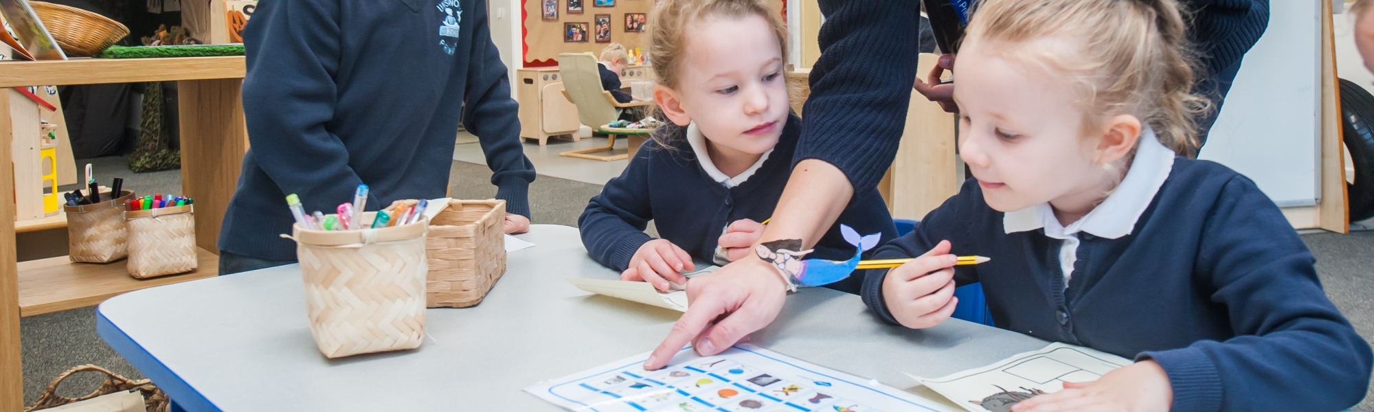
Our whole school geography enquiry took place across 2 weeks. The focus of the enquiry was on fieldwork skills as outlined in the National Curriculum, so that children could develop an ability to apply and analyse what they found out. The enquiry started within the school grounds to develop mapping activities in an area that the children were familiar with. It then moved into local areas such as Chadderton Fields, Whitefield Park and Heaton Park.
The aim of this page is to share the work that the children produced. Our school community were introduced to the enquiry through an assembly where Mrs Ali introduced the children to a mystery box that had arrived with a mystery clue for each class. Each class used their clue to find more clues and collect a mystery object, with the aim to work out who the objects belonged to. The culmination of the enquiry was a set of whole school displays about mapping and the creation of this digital gallery space.
In KS1 the children focussed on:
- Using simple compass directions and locational/directional language to describe the location of features on routes/maps.
- Using aerial photographs and plan perspectives to recognise landmarks and basic human/physical features.
- Devising simple maps with a basic key.
- Using observational skills to study the geography of the school grounds and Chadderton Fields.
In KS2 the children focussed on:
- Using the eight points of a compass.
- Developing the use of 4 and then 6 figure grid references.
- Understanding symbols and keys on Ordnance Survey maps.
- Using fieldwork to observe, measure, record and present the human and physical features in the local area in different ways such as sketching, collection of data or use of digital technologies (Mine craft).
Reception
The next challenge for Reception is using the directions North, East, South and West in other activities. Today, the children have been controlling ‘Beebots’ using directional language. The children are becoming familiar with the compass points and are beginning to use directional language in their independent play. Have a look at the photo gallery to see the ‘Beebots’ travelling around ‘Treasure Island’ and a maze created by some of the children.
Our library story and activity today was a wonderful story called ‘Can you catch a Mermaid?’ We then decorated a mermaid using a variety of materials to represnt seaweed, sand and fish scales!
The children have been creating treasure maps, staining the paper with teabags and drying it with a hairdryer. They then created their own map with different features eg: palm trees, sand dunes and X marks the spot! The children could confidently use directional language to say where their treasure had been buried! I am so proud of how hard they are working during this fabulous topic. Well done!
Another busy day in Reception. This morning, the children worked with Miss Nance to build a 3D map. They discussed different features that would be found on a ‘treasure island’. Have a look at their fabulous creation in our image gallery.
To end our week, the children have also been writing with quills, pirate style!! They enjoyed writing words with the feathers and paint even though they found it all extremely messy!!
Another busy week creating maps of the school playground, field and garden. The children set off in groups to find features in the school environment that they would find on a map. They took photographs of sheds, benches, trees etc and were able to discuss the different features that they found. The children then created large maps using the features and talked about the maps that they created.
Year 2
Year 2 made a great start to their enquiry with a QR code treasure hunt around the school grounds. The children had to scan each code to reveal the next part of their route and find the missing letters. The missing letters made a word that revealed where the hidden treasure was. The children really enjoyed finding out about how a treasure hunt is a route from one place to another.
Year 2’s next challenge was to learn how to orientate a map, plan a simple route and give directions.
Next Year 2 looked at an aerial view of our school and compared it to a plan that Mrs Reynolds had in her office. The children noticed that the photograph was taken a long time ago as the school grounds were very different. In pairs the children received a plan of the school with a route marked on it. They followed the route and as a class all met at the end of the route. Their next job was to plan their own route on the plan of the school and test it out.
Year 2 moved their learning of routes on, by using an aerial photograph of Chadderton Fields. As a class, the children took their photograph in pairs out to Chadderton Fields. As we walked around Chadderton Fields the children orientated their maps and marked on the route that they took.
The children reviewed all of the photographs and videos that they took and we decided to create a 3D contour map of Chadderton Fields. To do this we used modroc and paper to build up layers for the different parts of Chadderton Field. As the children worked on the model they matched it to the aerial photograph and also matched different photographs to the model. Throughout the creation of the model the children had to use different positional language and orientate the aerial photograph with the model to ensure features and contours were put in the right place. Once the model was made the children started to paint it and add different features.
Take a look at all our projects and some pictures of the process of creating the model and what the finished outcome was in the year 2 image gallery.
Year 3
Year 3 started the whole school enquiry with an outdoor clue hunt. Each clue had a mystery letter attached to it which corresponded to a mystery word. The children came back into the classroom to see if they could unscramble the letters to create a new word associated with holidays. The mystery word turned out to be POSTCARD! The children searched for a postcard and found it hidden in between a pair of wellies in Reception’s garden. Excitedly, we read the postcard, only to find that the name had been covered up! We returned to class and discussed who it could be from, who might write a postcard to our school? Who might like to visit a hot country? We decided it must be somebody who knew us very well. The children came up with a variety of suspects including Mr Dean, Mr French and some of our QFirst sports coaches!
Next, we headed back out into our outdoor environment to locate human and physical features. The children worked in pairs to organise the features they had found but to also specify where exactly in the environment they had found it. They brought all their fieldwork back into class to then plot the features they had found onto a map of our school. We discussed different symbols they could use to represent their objects and also incorporated this into our key.
The children used what they had found in their own environment to create their own aerial plan of a fictional school. They discussed which human and physical features they were going to include and plotted their objects onto a grid. They found it tricky to tell me which coordinates each object was in, particularly if the objects spread into more than one box. The children spent more time looking at coordinates in our maths lesson to help them verbalise their learning.
At the end of the week, the children were introduced to OS maps. We looked at an OS map of Manchester, Y3 couldn’t believe just how big Manchester actually was! They found other places of interest and used the key to help them identify what each symbol on the map represented. The children later took part in some practical activities to further their understanding of directional language. They planned and created routes for probots on large maps and also created routes for beebots on the iPads. They shared their directional instructions with others in the class to see just how clear their instructions were.
To finish the week, I worked with groups of eight children to read and find 4 figure grid references on OS maps and a map of our school. They learnt to record the 4 figure grid references and played instructional games with their partners based on what they had learnt Y3 completed the whole school enquiry by visiting Whitefield Park to complete some fieldwork on human and physical features. They shared their findings with other groups back at school. Each group then used large squared paper to create a large scale map of their own fictional park. They discussed the human and physical features on their park and plotted 4 figure grid references for each feature. They also created a northing and easting axis on their paper. Each group presented their completed maps.
Well done Y3!
Year 4
Year 4 started their enquiry topic by going on a treasure hunt around the school grounds. They followed the clues given to them and at the end they found… A mop!!! Who it belongs to we’re not sure…
Following our trail around the school grounds, Year 4 looked directions. To help us understand direction, we needed to learn about the 8 points of a compass. We wrote out each point and using a compass, we found North in our classroom and placed a marker on the wall. We did the same for all points around the room and following this, their task was to highlight placed items around the classroom, swap their findings and get them to locate their item in the correct direction.
The children later took part in some practical activities to extend their knowledge around directions. They planned and created routes for beebots on the iPads to challenge their partners understanding of the vocabulary.
Our next task was to look at mapping. We based our initial discussions around how we could read/find information on a map of the school grounds. We located the 4 digit coordinates along the outside edge of the map to see if we could pinpoint any particular areas of the school.
Next, we headed back outdoors into the school grounds to locate human and physical features. The children worked in pairs to organise the features they had found but also to specify where in the area they had found it. They did some sketching of the features they had seen (luckily it was dry!) Then we tried to recreate our own map of the school grounds, remembering that the map would be like looking at the school from above, rather than being three dimensional.
After that, they discussed which human and physical features they were going to include and plotted their objects onto a 4 figure grid. Locating specific coordinates for items that crossed over into more than one box of the grid. In our maths lessons, we looked at coordinates and plotting items on a grid to aid our learning and understanding.
Later in the week, Year 4 visited Whitefield Park. The focus of the trip was to complete some fieldwork on human and physical features outside of the school grounds. Once we returned to school, the children shared their features with one another.
Following this, to complete the whole school enquiry, Year 4 were put into pairs and groups of 3. Each group then used large squared paper to create a 3D scale map of their own residential area they had created, based around the maps we looked at around the area of Unsworth. We discussed the human and physical features that would be included on their maps and the key we would create to include the individual features.
Well done Year 4!
Year 5
Year 5 have made a great start to the geography enquiry. We started the week with receiving a special delivery which led us on a trail around school. At each point we discovered hidden treasure, which we pieced together to discover an interesting item…we speculated who the object might belong to. Any ideas?
Following on from this, the children shared maps which they had created for homework. The children had studied the locality in which they live and taken photographs, made simple drawing and sketched their own maps. We then worked in small groups to create a large floor map. The children considering the local amenities that were vital within a residential area and adding these onto their maps. We compared our sketched maps with “real” maps of the area, including different scale maps from Google images and aerial view maps.
Impressed with the discussion and ideas so far Year 5.
During the final part of the week, we moved onto looking at OS map of Manchester. The children familiarised themselves with locating different town and districts within the area of Manchester, reading a key and recognising what different symbols mean on the map. The children were amazed and the detail that the map included and the number of symbols used.
We based our initial discussions around how we could read/find information on such a complicated map. We located the numbers along the outside edge of the map and some of the terms used, such as eastings and northings.
The next skill we wanted to develop was fieldwork. We spent the morning at Heaton Park gathering information linked to the human and physical features that can be seen around the park. Initially the children struggled to orientate the map and locate where they were on the map!
As we walked around the park, we managed to follow the map and locate different features. Some feature we noticed were missing, so we had to annotate our maps to signpost features such as pathways, woodland areas, hilly grounds and tramlines.
We developed our maps further, creating symbols and a key which we used to record new features onto the maps. The children remembered symbols from the OS maps and used these alongside their own ideas. We gathered further information through making observational sketches and photographing. On returning to the classroom we used our information to develop our own maps of Heaton Park.
During the final part of the week we worked on developing our own map of the a virtual locality similar to Unsworth. We set out a plan for the area on paper, thinking about the amenities we would need and other physical features we might see. Having finalised the idea on paper, we moved onto developing a 3D plan using Minecraft.
The children really engaged with the task and within a few hours we had some excellent plans brought to life. We might have some future “Town Planners” in the making.
Year 6
Year six started our enquiry thinking about all the amenities in our local area and tried creating a plan illustrating these amenities and different features. It was actually quite tricky locating different features and trying to get them in accurate places.
On Thursday afternoon, the class worked in small groups to complete our treasure trail. Some of those clues sent by our mystery person really got us thinking.
We finally found a flat cap, I wonder who it could possibly belong to?
One of our next activities involved exploring Ordnance Survey maps of Manchester. We noticed the different symbols and colours used to represent different features such as different heights of land and how letters are sometimes used to represent certain buildings. The children gained some practical experience of using four and six grid references and how this links to northings and eastings .They particularly enjoyed finding places they knew: Castlebrook, Trafford Centre and Old Trafford to blame but a few.
After our Ordnance Survey maps it was time for some real life ‘hands on’ fieldwork. The class went with Y5 to Heaton Park equipped with an OS map to explore their own route. Each group traced their own route on the map and as they travelled through the park they made various sketches and took photographs of different features, which were then recorded on their map. Our challenge on our return to the classroom was to apply our geographical knowledge to create a ‘map’ ( a piece of work that represented our fieldwork observations) of Heaton Park.
Finally, the class worked in small groups to design their own virtual areas, which they then created using Minecraft. We had quite a few Minecraft experts in the class, who helped others to apply their mapping skills.
Links & Downloads
Gallery


